Alternative
17:0018:16
1 h 16 min · 1 change · Free in 2nd class
HamiliusBeaufort, Härewiss
Walk about 1 min to Hamilius-Centre (Tram)
17:01
T1towards Kirchberg, Luxexpo
19 min ride
17:20
Walk about 2 min to Kirchberg, Gare routière Luxexpo
5 min
On track · 5 min to change
2 min walk to Kirchberg, Gare routière Luxexpo for the 222.
Change · 3 min wait
17:25
222towards Beaufort, Härewiss
51 min ride
18:16
Near Beaufort

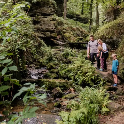
The educational path leads over about 5 km through the valleys of the Haupeschbach and the Halerbach. It is marked with a fossil oyster ("devil's claw"). It reminds us that the stones in the region were formed in a sea…

Read more

The educational path leads over about 5 km through the valleys of the Haupeschbach and the Halerbach. It is marked with a fossil oyster ("devil's claw"). It reminds us that the stones in the region were formed in a sea a long time ago. The valley is an extremely valuable area: it is a geotope of the Mëllerdall UNESCO Global Geopark, part of the European Natura 2000 network of protected areas, and has been on the list of national monuments since 1938. The path goes through the narrow valley in Luxembourg sandstone. At 14 interactive stations, one receives information about water: What does water have to do with the formation of sandstone? What processes can be observed today in a stream? What animals and plants live by the stream? Where does the water come from and how does man use the water and its power? Toward the end of the hike, you will pass by Beaufort Castle. The castle’s famous liqueurs are produced there, including Cassero, Cassero-Kirsch, Framboise des Bois, and Vieille Prune. The liqueurs are available for purchase on site. Hiking: Route 3 Mullerthal Trail, W5 (10.1 km), Geo-Pad Haupeschbach-Halerbach (4.9 km) Nearest bus stop: Beaufort, Härewiss (1.5 km)

  • 8 Rue de l'Auberge L-6315 Beaufort
  • Run by Geo-Pad Hapeschbaach an Halerbaach
  • Website
~2 min

The exhibition of the Mëllerdall UNESCO Global Geopark shows the creation and development of the special geological, natural and cultural heritage of the region. It tells of the formation of the geological subsoil as a…

Read more

The exhibition of the Mëllerdall UNESCO Global Geopark shows the creation and development of the special geological, natural and cultural heritage of the region. It tells of the formation of the geological subsoil as a seabed and of the shaping of the landscape after the seabed had become solid land. It takes up the human use of natural resources from the Stone Age to modern times and explains the development of the cultural landscape with its multitude of ecological niches. Free entrance! Closest bus stop: Beaufort, Härewiss (50m) Closest parking lot: Beaufort, Rue de l'église (50m)

  • 6 Rue de l'Auberge L-6315 Beaufort
  • Run by Natur- & Geopark Mëllerdall
  • Website

The circular route starts at the church in Beaufort and goes along the castles to the Thuillier kiosk, where you can take a relaxing break in the peaceful nature. The sections before and after the castles are quite…

Read more

The circular route starts at the church in Beaufort and goes along the castles to the Thuillier kiosk, where you can take a relaxing break in the peaceful nature. The sections before and after the castles are quite steep.

Data: Administration des transports publics and Luxembourg for Tourism, CC BY 4.0