Alternative
16:4117:26
45 min · 0 changes · Free in 2nd class
HamiliusBelvaux-Soleuvre, Gare
Walk about 2 min to Luxembourg/Centre, Monterey
Change · 1 min wait
16:44
606towards Hussigny, Place de l'Eglise
41 min ride
17:25
Walk about 2 min to Belvaux-Soleuvre, Gare
Near Belvaux-Soleuvre

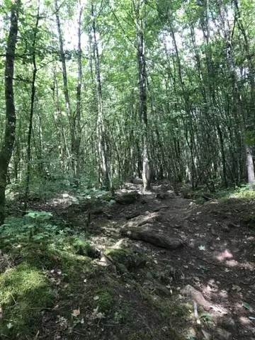
The route runs entirely along the national hiking trail Sentier du Sud. It includes extensive forest sections and offers an interesting view at the end of the former open-cast mining area Ronnebierg.

Read more

The route runs entirely along the national hiking trail Sentier du Sud. It includes extensive forest sections and offers an interesting view at the end of the former open-cast mining area Ronnebierg. This route can be well combined with the CFL hiking trails 26, Esch-sur-Alzette - Belvaux-Soleuvre (9km) or 28, Oberkorn - Niederkorn (8.9km). © Editions Guy Binsfeld

  • L-4010 Esch-sur-Alzette
  • Run by Visit Minett

The route offers views of the former Esch-Belval industrial area, once the center of Luxembourg's steel production. Today, Belval is a new economic and service center, which also hosts the University of Luxembourg. The…

Read more

The route offers views of the former Esch-Belval industrial area, once the center of Luxembourg's steel production. Today, Belval is a new economic and service center, which also hosts the University of Luxembourg. The associated ultra-modern Belval-Université station can be reached after the first 3.5 km of this hike. In the final section, starting approximately from Belval-Rédange station, the path rises by about 100 m. This last station is located near the French border. It serves the towns of Belvaux (L) and Rédange (F). This hike ends at Belvaux-Soleuvre station. Extension options: CFL hiking trails 24, Belvaux-Soleuvre – Belval-Université (4.2 km) or 27, Belvaux-Soleuvre – Oberkorn (4.8 km).

  • Rue de Belval L-4042 Esch-sur-Alzette
  • Run by Ville d'Esch
  • Website
Data: Administration des transports publics and Luxembourg for Tourism, CC BY 4.0