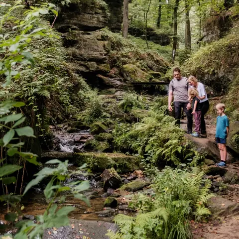
The educational path leads over about 5 km through the valleys of the Haupeschbach and the Halerbach. It is marked with a fossil oyster ("devil's claw"). It reminds us that the stones in the region were formed in a sea…
Read more
The educational path leads over about 5 km through the valleys of the Haupeschbach and the Halerbach. It is marked with a fossil oyster ("devil's claw"). It reminds us that the stones in the region were formed in a sea a long time ago. The valley is an extremely valuable area: it is a geotope of the Mëllerdall UNESCO Global Geopark, part of the European Natura 2000 network of protected areas, and has been on the list of national monuments since 1938. The path goes through the narrow valley in Luxembourg sandstone. At 14 interactive stations, one receives information about water: What does water have to do with the formation of sandstone? What processes can be observed today in a stream? What animals and plants live by the stream? Where does the water come from and how does man use the water and its power? Toward the end of the hike, you will pass by Beaufort Castle. The castle’s famous liqueurs are produced there, including Cassero, Cassero-Kirsch, Framboise des Bois, and Vieille Prune. The liqueurs are available for purchase on site. Hiking: Route 3 Mullerthal Trail, W5 (10.1 km), Geo-Pad Haupeschbach-Halerbach (4.9 km) Nearest bus stop: Beaufort, Härewiss (1.5 km)
- 8 Rue de l'Auberge L-6315 Beaufort
- Run by Geo-Pad Hapeschbaach an Halerbaach
- Website