Departures · Esch-sur-Alzette

Esch-sur-Alzette, Nossbierg

Live · updated 11:03
  1. 5
    Ehlerange, ZARE 2
    11:0711:08·1 min late
    4 min
  2. 651
    Oberkorn, Aquasud
    11:1611:18·2 min late
    15 min
  3. 5
    Ehlerange, ZARE 2
    11:22·On time
    18 min
  4. 651
    Oberkorn, Aquasud
    11:31·Scheduled
    28 min
  5. 5
    Ehlerange, ZARE 2
    11:37·On time
    33 min
  6. 651
    Oberkorn, Aquasud
    11:46·Scheduled
    43 min
  7. 650
    Belvaux, Belval Lycée
    11:49·Scheduled
    46 min
  8. 5
    Ehlerange, ZARE 2
    11:52·On time
    48 min
  9. 651
    Oberkorn, Aquasud
    12:01·On time
    58 min
  10. 5
    Ehlerange, ZARE 2
    12:07·On time
    12:07
  11. 651
    Oberkorn, Aquasud
    12:16·Scheduled
    12:16
  12. 5
    Ehlerange, ZARE 2
    12:22·On time
    12:22
  13. 651
    Oberkorn, Aquasud
    12:31·Scheduled
    12:31

Live times from mobiliteit.lu, refreshed every 30 seconds.

Near Esch-sur-Alzette

The route offers views of the former industrial area Esch-Belval, once the center of Luxembourg's steel production. Today, Belval is a new business and service center, also hosting Luxembourg's university. The…

Read more

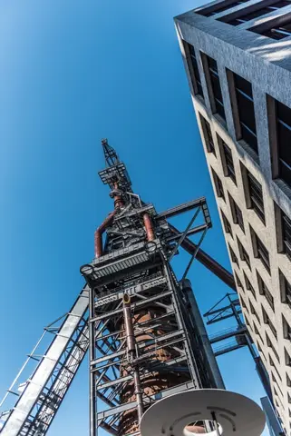
The route offers views of the former industrial area Esch-Belval, once the center of Luxembourg's steel production. Today, Belval is a new business and service center, also hosting Luxembourg's university. The associated state-of-the-art Belval-Université station is reached after the first 3.5 km of this hike. In the final section, from around Belval-Rédange station, the path rises by about 100m. The latter station is close to the French border. It serves the towns Belvaux (L) and Rédange (F). This hike ends at Belvaux-Soleuvre station. © Editions Guy Binsfeld

  • Rue de la Gare L-4460 Sanem
  • Run by Ville d'Esch
  • Website

The route starts in Ellergronn heading up towards Gaalgebierg up to the animal park “Escher Déiérépark”. The park is freely accessible and free of charge. After ascending to Gaalgebierg, the path goes down through the…

Read more

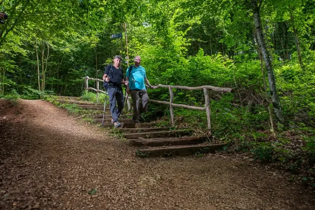
The route starts in Ellergronn heading up towards Gaalgebierg up to the animal park “Escher Déiérépark”. The park is freely accessible and free of charge. After ascending to Gaalgebierg, the path goes down through the forest again into Ellergronn. Here you pass a quiet pond and walk back to the Nature Conservation Center and the Museum Mine Cockerill.

D’Camping’s Stuff near Gaalgebierg has been run by CIGL Esch since 2017. In summer, the restaurant is a popular place to escape the hustle and bustle of the city center and spend a few quiet moments surrounded by…

Read more

D’Camping’s Stuff near Gaalgebierg has been run by CIGL Esch since 2017. In summer, the restaurant is a popular place to escape the hustle and bustle of the city center and spend a few quiet moments surrounded by greenery. Max Schmit is the coordinator of Camping’s Stuff and spoke to the Escher Blog about recent developments and his plans for the future.

  • Rue du Stade L-4325 Esch-sur-Alzette

The second part of the Natura 2000 trail leads over the "Gaalgebierg", the "Eisebierg" and past the place called "Gléicht".

Read more

The second part of the Natura 2000 trail leads over the "Gaalgebierg", the "Eisebierg" and past the place called "Gléicht". Places to discover (among others): Gaalgebierg Park Garden city "Op der Schneier" Forest school "Waldschoul" exceptional landscape of an old open-cast mine Haedefeldchen pit entrance

  • L-4114 Esch-sur-Alzette
  • Run by Natura 2000 Weg - Boucle B: « L’exploitation des terrains ferrières, jadis et aujourd’hui » – 4,5 km
Data: Administration des transports publics and Luxembourg for Tourism, CC BY 4.0